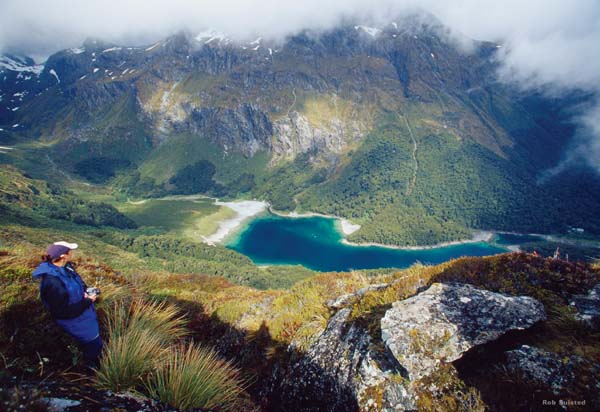
Routeburn Track is one of the most popular hiking trails in New Zealand, located near Arthurs Point on the South Island. This stunning track offers hikers a chance to experience some of the country's most breathtaking scenery, including lush forests, crystal-clear rivers, and towering mountain peaks.
The Routeburn Track is a 32-kilometer long trail that typically takes around three days to complete. Hikers can choose to start at either end of the track – at the Routeburn Shelter near Glenorchy or at The Divide near Te Anau. Along the way, they will pass through diverse landscapes, from beech forests to alpine meadows.
One of the highlights of the Routeburn Track is the stunning views of Lake Mackenzie and Key Summit. Hikers can also spot native bird species such as kea and fantails along the trail. The track is well-maintained and relatively easy to navigate, making it suitable for hikers of all skill levels.
For those looking to hike the Routeburn Track, here are some key points to keep in mind:
- The best time to hike the Routeburn Track is during the summer months (November to April) when weather conditions are more favorable.
- Hikers should be prepared for changing weather conditions and pack appropriate clothing and gear.
- Hut accommodation is available along the track but must be booked in advance during peak season.
- A moderate level of fitness is required to complete the track, as there are some steep sections and river crossings.
- Hiking permits are required for overnight stays on the track and can be obtained from the Department of Conservation website.
Overall, hiking the Routeburn Track is a truly unforgettable experience that allows visitors to immerse themselves in New Zealand's stunning natural beauty. Whether you're an experienced hiker or just looking for a scenic adventure, this iconic trail has something for everyone.